
HartRAO Home > Things to do > Visit Deep Impact - The Vredefort Dome
One hundred kilometers south west of Johannesburg, South Africa are the towns of Vredefort and Parys, the latter lying next to the Vaal river. The towns are a short deviation from the N1 highway to Cape Town. In an arc to the north and west of the towns is a partial ring of hills, some 70 kilometres in diameter. The hills are centred on Vredefort, which is shown by the letter "V" in the photograph below, taken from the Space Shuttle. The ring of hills and the area within them is known as the "Vredefort Dome".
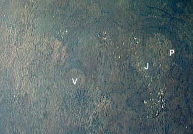
From high altitude these hills bear a strong resemblance to the larger, near-circular ring of hills north-east of Vredefort, whose northern side, the Magaliesberg hills, cuts through Pretoria (letter "P") and whose southern side, the "Witwatersrand" ridge, cuts through Johannesburg (letter "J"). These surround the uplifted area known as the "Johannesburg Dome". The white dots running in a band along the Witwatersrand are not clouds, they are the waste dumps from the gold mines along the south side of the Witwatersrand. West of Johannesburg and due north of Vredefort can be seen the gold mine dumps of Carletonville. The gold mines of Klerksdorp and Welkom lie north-west and south-west of Vredefort, and their dumps are also easily seen.
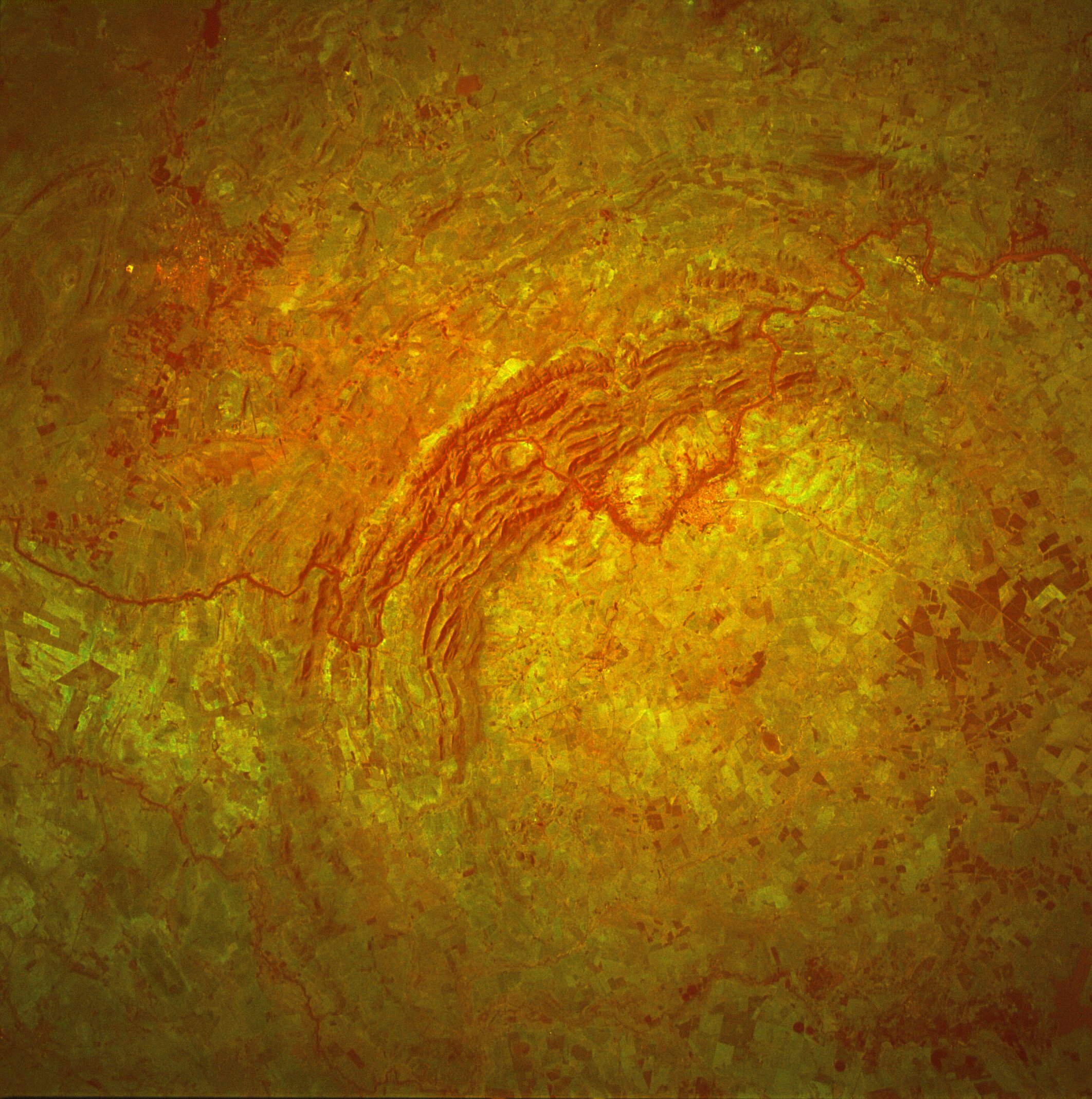
Pictured above is a higher resolution view of the Vredefort hills from space. The Vaal river meanders through the hills, flowing from north-east (upper left) to west (centre right). Parys (the Paris of South Africa!) lies on the loop of the river protruding within the ring of hills. Vredefort is close to the geometric center of the hills.
Only the north western half of the structure remains visible. The south eastern half was flooded by the sediments of the Karoo Supergroup, which cover the Free State province.
Courtesy of Google, there is also now a satellite image in which you can zoom in or out.
The same rock layers seen in the Witwatersrand are found in the Vredefort dome hills, but here they are found standing nearly vertically - the result of extreme upliftment.
Evidence has been found by geologists that the cause of this upliftment was an extreme impact event, caused by an asteroid some 10 kilometres in diameter. The ring of hills we see now are the eroded remains of a dome created by the rebound of the rock below the impact site after the asteroid hit. The original crater, now eroded away, is estimated to have been 300 kilometres in diameter. Some 70 cubic kilometres of rock would have been vaporised in the impact.
The Vredefort structure is currently regarded as one of the biggest and oldest clearly visible impact structures on Earth. It just beats the Sudbury impact structure in Ontario, Canada in size and age. The Sudbury structure is some 250 km in diameter and is estimated to be 1850 million years old.
Much smaller, but older, is the 16km diameter water-filled Suavjärvi crater in Russia, which is estimated to be older than Vredefort, at ~2400 million years.
In 2012 Adam Garde of the Geological Survey of Denmark and Greenland found evidence of an impact structure centred near the town of Maniitsoq on the south-west coast of Greenland, which may be larger and older than Vredefort. It is believed to be 2975 million years old. There is no obvious crater left to find; what remains is about 100 km in diameter. The news was published in a paper in Earth and Planetary Science Letters of 1 July 2012, Volumes 337-338, Pages 197-210.
Evidence of four impacts even older than than these, that occurred 3.2 to 3.5 billion years ago, has been found in the greenstone rocks around Barberton in South Africa and corresponding rocks in the eastern Pilbara block of Western Australia. However, these impacts are no longer recognizable as structures on the surface like Vredefort's.
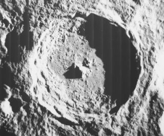
The central mountains in the 85 kilometre diameter lunar crater Tycho show what the Vredefort dome is the remains of - the central rebound peak, NOT the crater itself, which at Vredefort has long since eroded away. The erosion processes occuring on Earth are of course missing on the Moon, hence the "as new" appearance of Tycho.
What is the evidence for the impact at Vredefort?
The pictures below tell some of the story.
Click on pictures below with a blue outline for a larger view of the image.
|

|
| click on images for full size pictures | credit: M Gaylard |
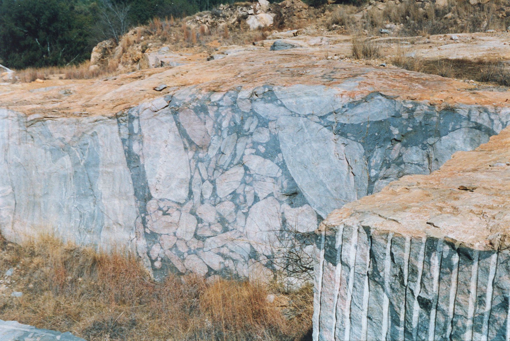
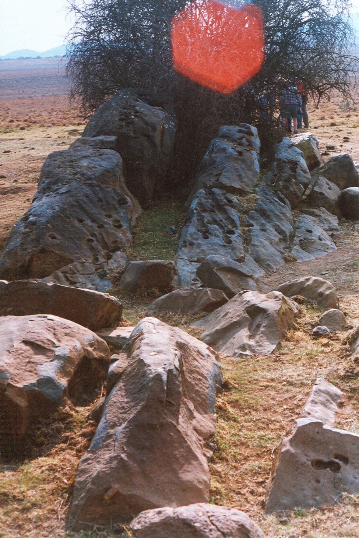
Within the ring of hills at Vredefort is found granitic gneiss rock - as in the Johannesburg Dome - which is dated at some 3200 million years old. Here a quarry at Leeuwkop near Parys reveals one of the indicators of the impact. The image above left shows the cut surface of the rock. The pale and medium greys on the left are the natural colours of the granite. But from the centre to the right edge is a wide dark grey band containing large and small fragments of the granite. This is "pseudotachylitic brecchia" - the dark grey is granite that was melted by the impact and flowed, carrying chunks of unmelted granite within the melt. The vertical face seen here is two to three metres in height.
The image above right is of a nearly horizontal exposure of pseudotachylite at the quarry. The width of the band is about one metre. Similar rock is found at elsewhere, in geological faults where rocks move against each other and melt at the interface, but this produces a melt band that is centimetres rather than metres wide as seen here.
The basement granite exposed within the ring of hills is estimated to have been seven to ten kilometres beneath the surface when the impact occurred, which is dated at 2000 million years ago. The date was established from zircon crystals found in the pseudotachylite and granophyre (below), and, more precisely, is 2023 +- 5 million years. All the covering rock has since been removed by erosion. Later the south-east part was covered by much younger Karroo rock formations.
|
|
| click on images for full size pictures | credit: M Gaylard |
|

|
| click on images for full size pictures | credit: M Gaylard |
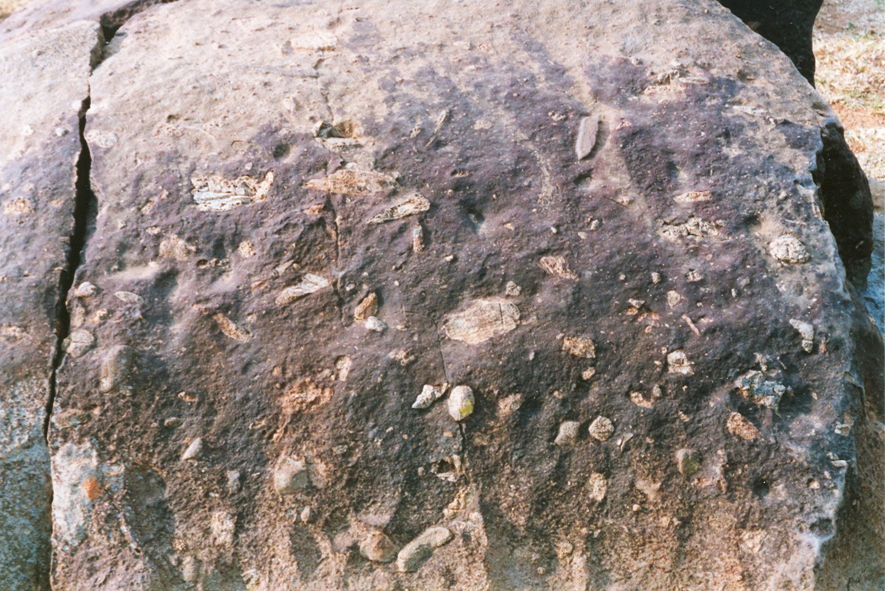
The boulder in the dyke shown above on the left shows the small, fractured inclusions of unmelted rock that are typically 1 - 3 cm in size. This is much smaller than the rocks embedded in the pseudotachylite at the quarry, which are up to metres in size. The small inclusions may have come from considerable distances - tens of kilometres away.
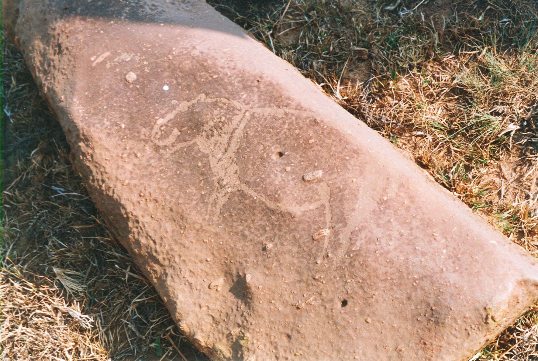
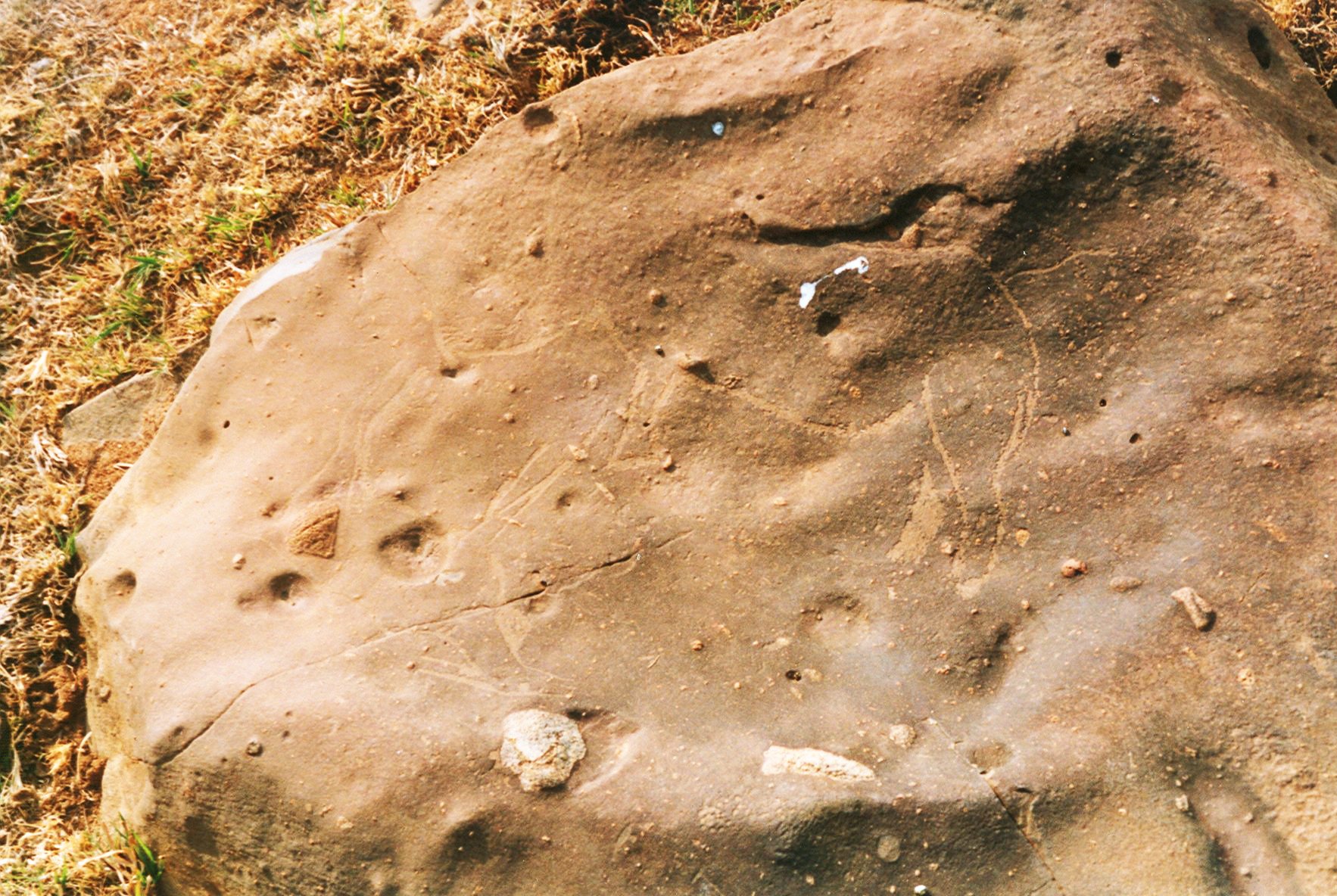
These rocks have also been the target of graffiti artists - in this case San hunters perhaps 2000 years ago. On the right above is an enigmatic figure carved in the rock.
|
|
| click on image for full size picture | credit: M Gaylard |
|

|
| click on images for full size pictures | credit: M Gaylard |
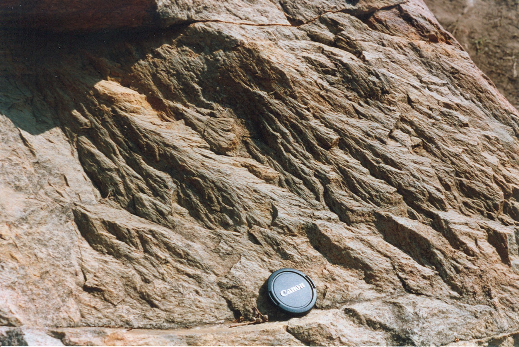
Another signature of an impact is left by the passage of shockwaves through the underlying rock. This produces fractures with a characteristic "fir tree" pattern. In this particularly clear example found next to the Vaal river at Schoemansdrif, the shock wave passed through from upper left to lower right. The lenscap from a 35mm camera provides the scale in one picture.

|

|
| click on image for full size picture. | credit: M Gaylard |
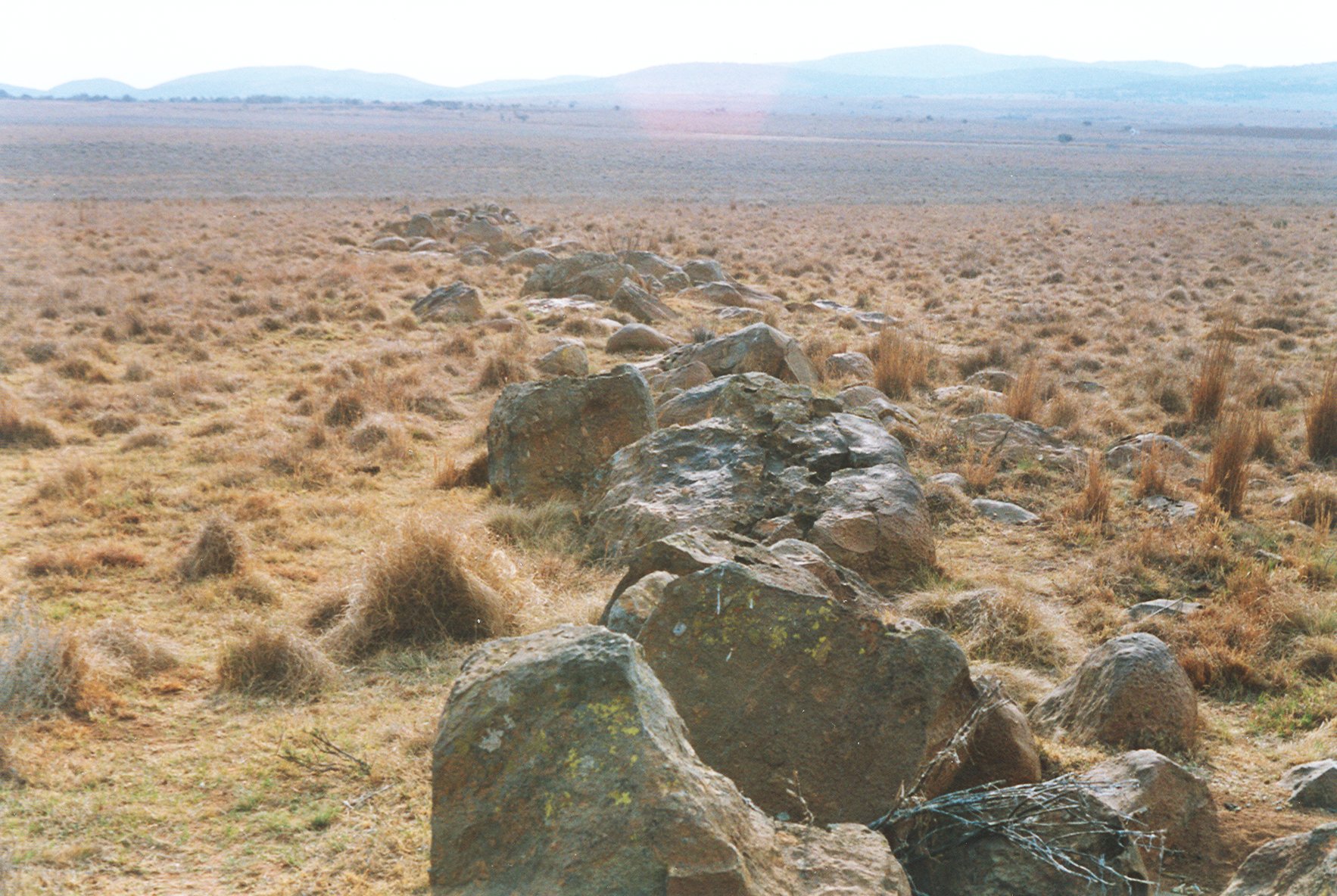
The view above left is a panorama over the Vaal river. It was taken facing west, at Schurwedraai. The next ring of hills forms the horizon.
The rocks at the site where the photograph of the river was taken at Schurwedraai are quite different to the basement granite, but also show dark grey veins of pseudotachylite - melted rock. The pen gives the scale in the picture on the right.

This ring of hills comprises quartz conglomerates as found in the gold-bearing strata of the Witwatersrand reefs. The white quartz pebbles are evident. This was once the bed of a fast flowing water course which deposited grains of quartz and the pebbles. This area was mined for gold in the 1880's. However the concentration of gold was much poorer than at Johannesburg, and the diggings were soon abandoned. Old mine adits are still to be seen in the hills. This is the Amazon Reef.
|
|
| click on image for full size picture. | credit: M Gaylard |
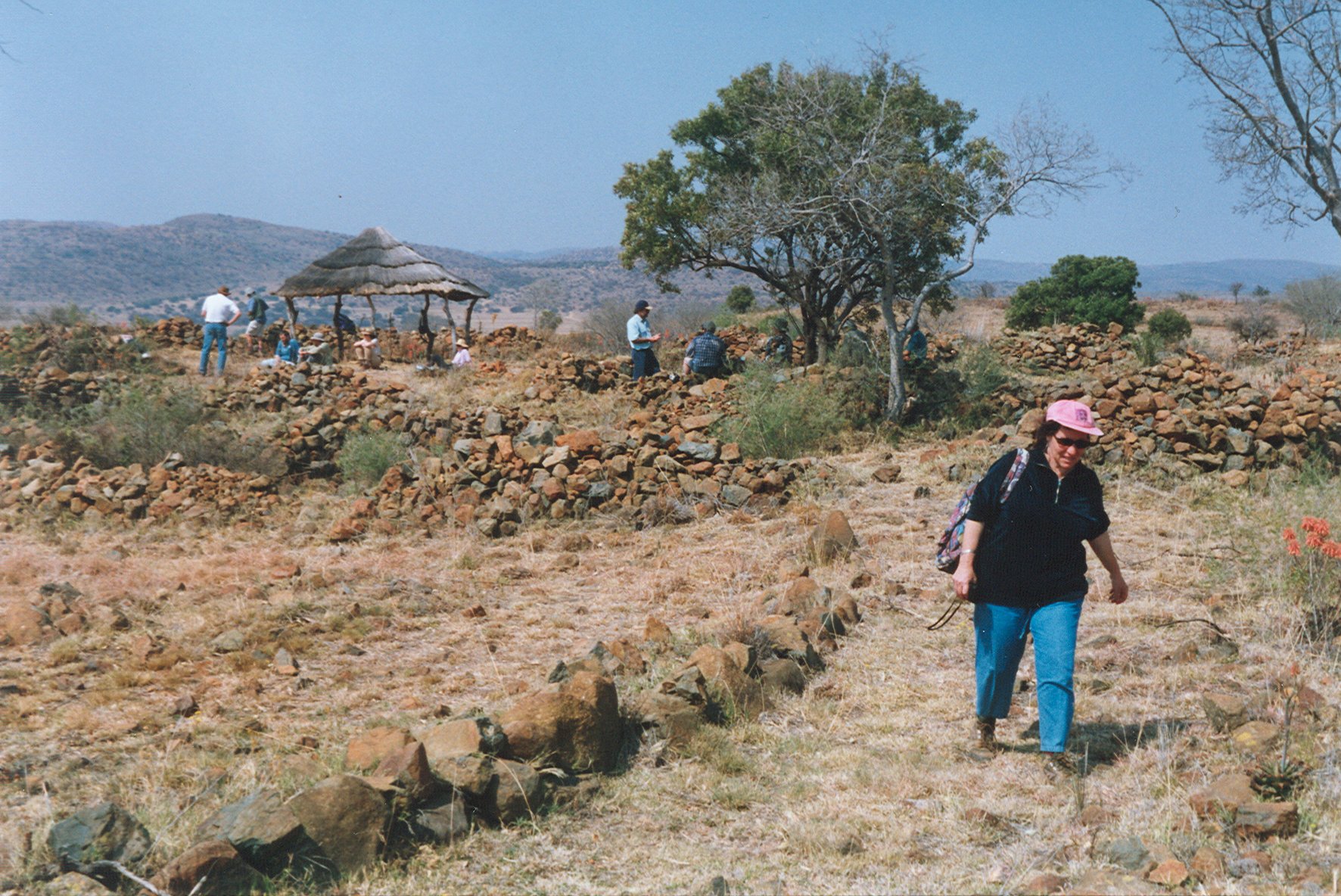
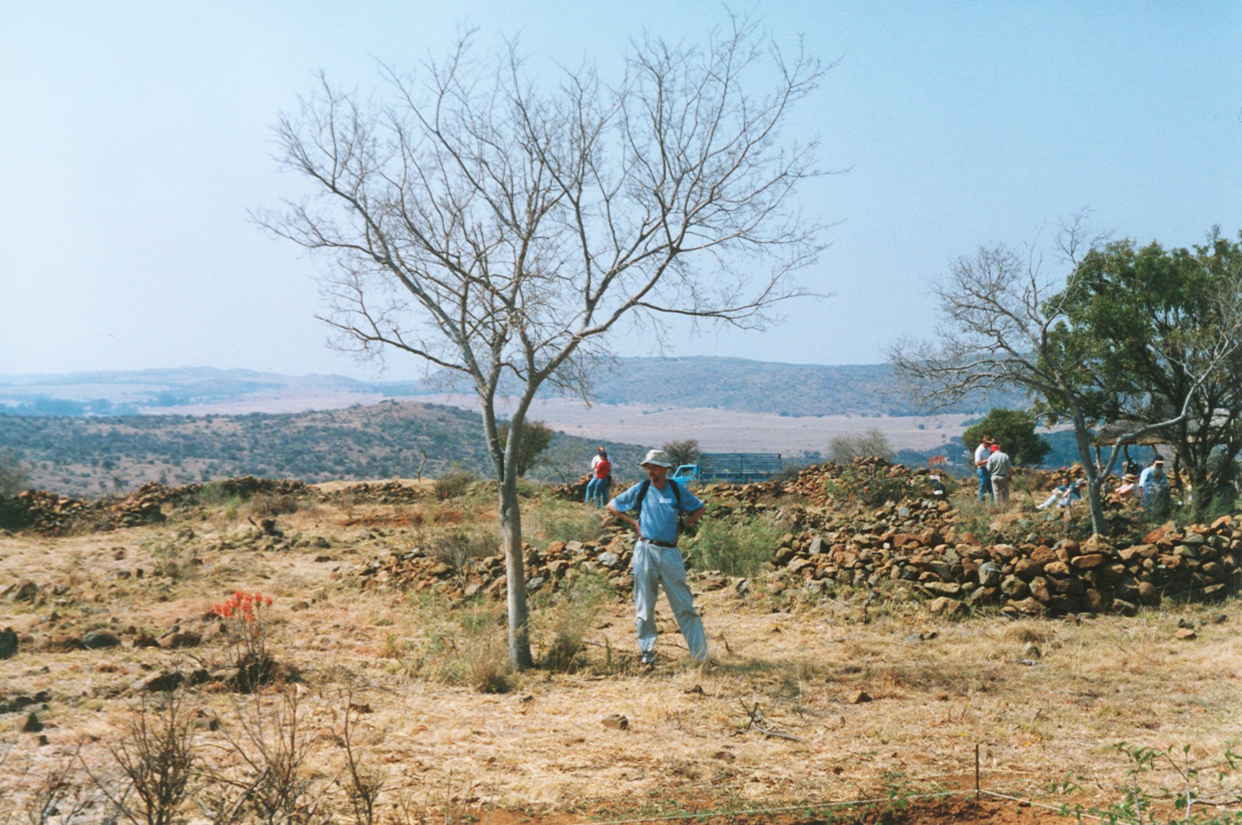
The outermost ring of hills was home to a quite different group of people in the 1500's to 1700's. These were SeSotho / SeTswana-speaking farmers. This village at Askoppies was a defensive position on the crest of the hill, but it did not save the village from destruction, by the warriors of Mzilikazi. The views shown above left look southeast and east respectively, back in towards the inner rings of the Vredefort dome.

The stone walls of the village are shown above right. They are made of the fine-grained grey Ventersdorp lavas that comprise this ridge. These rocks are 2700 million years old.
The 200 000 year old, 1 km wide Tswaing crater, 40 kilometers north of Pretoria, provides an interesting contrast to the Vredefort impact structure.
In 2005 July WU Reimold and RL Gibson published "Meteorite Impact! The danger from space and South Africa's mega-impact the Vredefort Structure", ISBN 1-919908-62-5. Contact Chris van Rensburg Publications at +27 (0)11 726-4350 or the Johannesburg Planetarium. Intended for a general audience, it is copiously illustrated.
The photographs shown here were taken on a very informative tour of the area led by Roger Gibson and Uwe Reimold in 2001 September. They are with the School of Geosciences at the University of the Witwatersrand. For serious enquiries, these are experts.
For the geologist, 1:50 000 scale geological maps of the area are available from the South African Council for Geosciences, together with an explanatory booklet "The Geology of the Vredefort Dome", written by A.A. Bisschof, ISBN 1-875061-60-6, published 1999 by the Council.
The 'Earth Impact Effects Program' by Robert Marcus, H. Jay Melosh, and Gareth Collins, is an easy-to-use, interactive web site for estimating the regional environmental consequences of an asteroid impact on Earth. This program will estimate the ejecta distribution, ground shaking, atmospheric blast wave, and thermal effects of an impact as well as the size of the crater produced, after you set up the asteroid parameters.
To get to Parys and Vredefort from Johannesburg or Tshwane / Pretoria, take the N1 south from Gauteng. Turn off at the Parys offramp shortly after crossing the Vaal river. You will drive through part of the impact structure in reaching these two towns.
The Vredefort Dome viewsite just outside Vredefort is at 26° 59' 22.90" S, 27° 22' 26.64" E. A new Visitor's Centre is being built there.