
HartRAO Home > news > GNSS installation for troposphere calibration, Hamburg, South Africa, 2010/04/30
The purpose of the station is to help quantify long-term variability in the Agulhas Current via improved Coastal Altimetry in combination with data from a state-of-the-art full-depth current moorings array deployed by the University of Miami, off the Eastern Cape coast. Captured GNSS data will help to model the troposphere, which will provide corrections for the area and will be included in the processing of altimetry data obtained by satellites. These satellites (Topex and Jason) pass over Hamburg, as well as over the array of current moorings. Topex and Jason were also tracked by the NASA MOBLAS6 Satellite Laser Ranger at HartRAO. Additional uses of the GNSS data include densification of the southern African GNSS network for surveying work, ionospheric modelling and crustal stability studies.
Understanding how climate change affects the oceans is very important, as the oceans play a major part in the energy and mass distribution on Earth. The Agulhas current affects the southern African climate, is a regulator of global climate change, so its variability will directly impact on farming and other economic activities. It is only through understanding the causes and processes which change our environment, that we can adopt alternatives and remedial strategies which will ensure continued productivity and minimal adverse impact on economic activities.
Recent modelling studies which are supported by satellite and other observations, suggest Agulhas Leakage (the transport of warm and salty Indian Ocean waters into the Atlantic Ocean ) is increasing as a result of changes in atmospheric pressure and shifts in winds resulting from global warming, resulting in more upper-layer salt export into the North Atlantic. The Agulhas Leakage is the main source of heat and salt for the surface branch of the Atlantic Meridional Overturning Circulation (AMOC) and therefore affects its stability.
This installation was done by Ludwig Combrinck of HartRAO in collaboration with Dr. Paolo Cipollini (National Oceanographic Centre, Southampton), Dr. Luisa Bastos (University of Porto) and Dr. Lisa Beal (University of Miami). Andre van der Merwe of the HartRAO mechanical workshop fabricated the GNSS station monumentation.
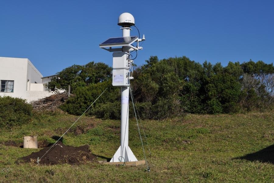
Left click on image for large version.
HartRAO GNSS station located at Hamburg, situated on top
of a hill which allows a clear horizon and access to GNSS satellites. The
site is at the Hamburg Clinic, supported by the Dept. of Health.