HartRAO Home > news > SLR Opening 2000/11/20
Director of HartRAO George Nicolson opened the workshop with a history of the development of Space Geodesy techniques at HartRAO. Initially this was only by means of VLBI, using the radio telescope as part of world networks of telescopes. He showed that positional measurements in the 1970's and early 1980's had an accuracy of the order of 1 metre, but the introduction of the hydrogen maser frequency standard and the Mk III VLBI terminal brought the positional error down to 10 centimetres and then to 2 centimetres. The upgrade of the terminal to Mk IV standard from 1998 has brought the positional error down 5 millimetres, and the error in the long term measurement in the site velocity down to 0.3 millimetres.
A German SLR was installed at Hartebeesthoek and then at Sutherland for a few months in 1993, and showed the value of such a system for filling in gap in the data from Africa.
GPS receivers have been operational at HartRAO since 1998, as one of some 300 world-wide stations providing accurate site postions.
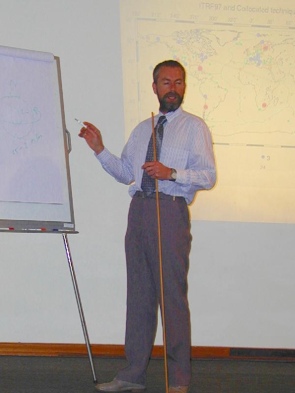
John Bosworth of the NASA Space Geodesy Programme at the Goddard Spaceflight Centre discussed the value of the co-location of the three accurate postioning techniques, VLBI, SLR and GPS. He showed that it was possible to achieve 1 - 2 millimetre normal point precision from one to two minutes of satellite tracking data from an SLR, and that satellite orbits could be measured to an accuracy of 1 - 3 centimetres for the Lageos and GPS satellites. He noted that Hartebeesthoek is one of only 37 SLR stations and one of 30 geodetic VLBI stations around the world. He commented that VLBI is particularly useful in providing the most accurate length of day measurement, and provides an inertial reference frame. The SLR excels at measuring time-variable gravity and the Earth's centre of mass.
Richard Eanes of the Centre for Space Research at the University of Texas at Austin, Texas discussed Earth system dynamics and how space geodesy data are used to constrain models of the behaviour of the system.
John Luck of the Australian Survey and Land Information Group (AUSLIG) described the operation in Australia of two satellite laser ranging systems, one being a MOBLAS system similar to that installed at HartRAO. He made a friendly challenge to the South African operation to match the data quantity and quality achieved by the Australian systems.
Bruce Schupler of Honeywell Technology systems discussed timing and calibration in VLBI and GPS receivers.
Richard Wonnacott of the Chief Directorate: Surveys and Mapping in South Africa discussed the development of survey techniques in the country. He noted the major improvement in position determination effected by the introduction of the space geodesy-based techniques using Hartebeesthoek as the reference datum.
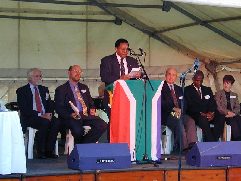
The workshop ended with a discussion by Ludwig Combrinck, Manager of the Space Geodesy Programme at Hartebeesthoek, of the benefits of the new SLR together with the co-located GPS and VLBI measurements, and its implications for South Africa and Africa. He noted that Hartebeesthoek is the first site in the southern hemisphere to have all three systems together, permitting accurate intercomparison of their results. He said that HartRAO had already installed additional GPS receivers attached to tide guages at Richards Bay and Simon's Town in South Africa, and at Windhoek in Namibia. It is intended to extend this network into the rest of Africa. He welcomed the presence of delegates from Zambia in this regard.
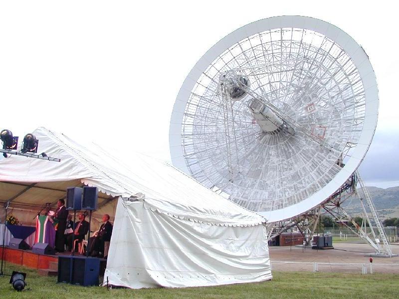
As the evening grew darker guests were able to watch the radio telescope driving across the sky, tracking quasars in the depths of the Universe as part of a three-telescope VLBI experiment with the radio telescopes at Syowa in Antarctica and Hobart in Tasmania, while the green laser beam of the satellite laser ranger pulsed overhead.
Click on the pictures below for more detailed views.